How will Asia connect billions through resilient transport systems?
Asia’s transport networks must evolve to deliver sustainable, connected mobility. Learn how Aurecon is shaping Asia with innovative infrastructure solutions.


Change your location to view content tailored for you.
Singapore, a low-lying island nation with approximately 30% of its land less than 5 metres above mean sea level[1], is highly susceptible to climate risks such as intensified rainfall, sea level rise, and high tides, all of which increase its flooding vulnerability. Extensive coastal developments including land reclamation, ports, and urban infrastructure require long-term, climate-informed strategies to safeguard resilience and manage costs.
This insights paper explores how integrating numerical modelling into coastal development decisions enables coastal cities such as Singapore address these challenges. By simulating complex processes such as tidal currents, waves, sediment transport, and water quality, advanced numerical models provide detailed, site-specific insights essential for effective planning. Incorporating climate projections into numerical simulations allows Singapore to assess future risks and test mitigation strategies, supporting the development of a sustainable, climate-resilient coastal infrastructure.
Recognising its climate vulnerabilities, Singapore has adopted a targeted approach to strengthen coastal and urban resilience. The Centre for Climate Research Singapore (CCRS) produces high-resolution climate projections for downstream use across multiple sectors, ensuring planning decisions are based on robust data.
Complementing this, Public Utilities Board (PUB), Singapore’s National Water Agency, conducts site-specific coastal studies to assess localised risks and evaluate tailored protection measures. These scientific efforts are supported by policy tools such as the Flood Resilient Development Guidebook[2], to be launched by mid-2026, which will outline best practices for designing developments that can withstand flooding and adapt to changing climate conditions.
Numerical modelling is a flexible, cost-effective tool that should be used across all stages of coastal projects, providing insights that enhance planning and decision-making.
A key part of this strategy is numerical modelling, which enables planners and engineers to simulate future scenarios and develop suitable mitigation measures, and ensures Singapore’s coastal and urban infrastructure is both climate resilient and cost effective. The Long Island project is one example where modelling supports assessments of sea level rise and storm intensity, placing climate change considerations at the core of project planning.
This video shows current flow field around Singapore Island simulated using hydrodynamic model. The arrows indicate the direction of current flow, while the colour scale represents current speed magnitude, with blue/green areas indicating slower currents and orange/red indicating faster currents, particularly through the Singapore Strait.
With recent advances in mathematical modelling and increased computational power, numerical models can now simulate coastal processes at higher spatial resolution and over extended simulation periods.
Numerical modelling is more cost-effective and flexible compared to field investigations, which cannot quantify or predict the changes to coastal hydrodynamics arising from new developments or future conditions. It allows the exploration of numerous design scenarios and the assessment of potential environmental impacts throughout the project lifecycle.
For instance, hydrodynamic model simulates flow dynamics in estuaries and tidal coastal areas, enabling assessment of change in current velocities and water levels under proposed coastal development such as reclamation. Local wave models simulate how waves transform as they move from offshore to nearshore zones, allowing evaluation of wave penetration and altered wave climates due to proposed coastal structures. Outputs from these models often feed into coupled sediment transport models to predict sediment movement and seabed changes, as well as water quality models to track pollutant dispersion.
Given its flexibility and broad coverage, numerical modelling supports not only climate-related studies but also a wide range of other applications across project phases.

Feasibility studies – Assess design viability and risks by modelling existing marine conditions (e.g., tides, currents, waves) to support preliminary decisions: for example, optimal placement of seawater intake and outfall structures.

Environmental impact assessments (EIA) – Quantify development impacts by comparing pre- and post-construction scenarios using hydrodynamic, wave, sediment transport, and water quality models. These analyses guide mitigation strategies to meet environmental standards.

Detailed design studies – Refine engineering parameters with high-resolution simulations to define design loads, optimise diffuser layouts for outfalls, and evaluate scour effects around structures.

Environmental management and monitoring plan (EMMP) – Support compliance during dredging and reclamation through sediment plume dispersion forecasts and hindcasts, informing early warning systems and the design of mitigation measures like silt curtains.

Post-construction monitoring – Numerical modelling is not commonly used for post-construction monitoring; however, marine biodiversity and environment quality monitoring is more commonly implemented at this stage. Through these functions, numerical modelling enhances the understanding and management of coastal systems, providing robust, site-specific insights that improve project sustainability and resilience.
Climate change considerations are not limited to EIA for new developments. Numerical modelling is also a vitally important tool for climate risk assessment and adaptation planning for coastal infrastructure.
In Singapore, coastal and marine projects are now expected to assess not only current impacts but also how climate change may alter those impacts throughout the project’s lifespan – from feasibility studies to EIAs and long-term operation. This reflects a broader shift towards resilience-based planning for long-lived coastal assets.
Traditionally, EIAs have focused on evaluating baseline environmental conditions and predicting immediate impacts of new developments under existing climate conditions. However, there is now growing emphasis on assessing potential impacts under future climate scenarios, reflecting heightened concerns from both authorities and the community about climate resilience.
Current practice can integrate projections from regional climate studies such as the V3 Report by the CCRS[3]. These high-resolution projections, like sea-level rise, temperature changes, and change in weather patterns, can be incorporated into numerical modelling to assess how climate drivers could influence project-specific impacts.
This approach also supports cumulative impact assessments, evaluating how a project’s effects may interact with other developments in the area and with long-term climate change stressors.
The following examples demonstrate Aurecon's experience in coastal protection projects across the region. While these projects employed varying degrees of modelling, engineering and environmental expertise, each directly addresses climate resilience and coastal adaptation to mitigate future risks.
Aurecon delivered a 400-metre wave screen for the Republic of Singapore Yacht Club marina, enhancing the marina’s coastal resilience and protecting coastal infrastructure against climate variability.
As the appointed Professional Engineer (PE) and Qualified Person (QP), Aurecon provided project management, detailed design through construction supervision, covering civil, structural, geotechnical, and foundation engineering. The project was executed in partnership with Marina Technology and Construction.
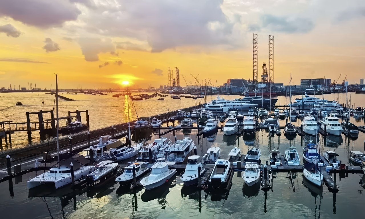
Design and Construction of Wave Screen at Republic of Singapore Yacht Club. Image source: Sailing Click.
Aurecon provided preliminary and detailed design for the greenfield Wiggins Island Coal Terminal, a large-scale coastal reclamation project. The design encompassed terminal infrastructure, settlement ponds, rock rip-rap seawalls, and a barge loadout facility featuring a low-level rock-armoured causeway. The integrated coastal protection measures enhance climate resilience by safeguarding critical infrastructure against marine conditions.
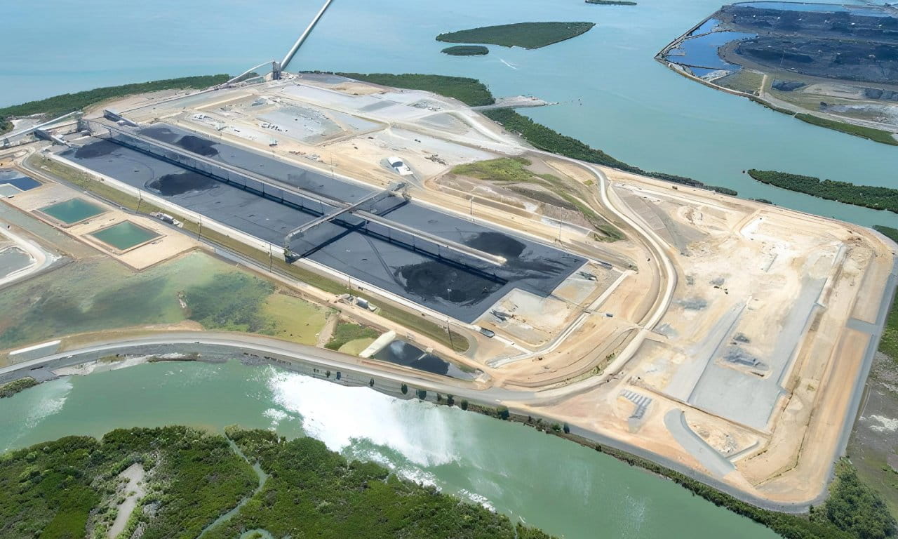
Aerial view of the stockyard at Wiggins Island Coal Terminal. Image source: Wiggins Island Coal Terminal Project.
Aurecon has delivered several seawall projects for Eurobodalla Shire Council, including the Casey's Beach seawall project. The existing seawall showed significant deterioration with under-sized rock, slumping of armour and undermining of the rock toe, as well as regular overtopping by wave action.
Aurecon delivered scoping, preliminary design and detailed design for the upgrade and repair of seawalls, including targeted repair and renewal in certain locations, and replacement upgrade in others.
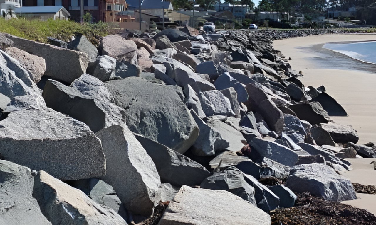
The seawall for Eurobodalla Shire Council. Image source: Casey's Beach seawall upgrade.
Numerical modelling is an essential tool in coastal project planning, particularly as climate-related risks increase globally. Coastal cities like Singapore, can use this approach to better understand and estimate threats such as rising sea levels and intense storms.
Through numerical modelling, planners and engineers can cost-effectively assess and capture a wide range of potential climate-related risks. While not a complete solution on its own, this predictive tool supports more informed decision-making and helps guide targeted measures to reduce damage and strengthen resilience. When integrated with other strategies and measures, numerical modelling contributes meaningfully to building more adaptive and sustainable coastal communities capable of responding to the evolving challenges posed by climate change.
Engage our expertise in numerical modelling to support a wide spectrum of projects, including coastal, marine, infrastructure, building, and near-shore developments. We deliver practical, data-driven insights that enable effective risk management and inform resilient, sustainable planning and design.
[1] National Climate Change Secretariat, 2024, Impact Of Climate Change In Singapore.
[2] The Straits Times, May 2025, PUB to Launch Guidebook for Building Owners, Developers to Enhance Flood Resilience of Premises, Singapore Press Holdings.
[3] Singapore’s 3rd National Climate Change Study (V3), March 2013, V3 Report by the CCRS.

Consultant, Environment – Singapore

Lead Consultant, Environment – Singapore

Director of Operations, Environment – Singapore
Asia’s transport networks must evolve to deliver sustainable, connected mobility. Learn how Aurecon is shaping Asia with innovative infrastructure solutions.
In a cost-constrained environment, nature-based solutions offer cost-effective approaches to enhance New Zealand's infrastructure resilience, while supporting decarbonisation efforts.
Exploring how floating solar technology offers Southeast Asia a viable solution for meeting renewable energy targets despite land constraints.