

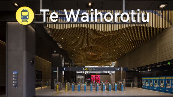
Auckland City Rail Link, New Zealand
Auckland’s first underground railway system will reduce congestion, bring people closer to job and amenities, and unlock new development potential.



Change your location to view content tailored for you.
In 2010 and 2011 Christchurch was shaken by a series of devastating earthquakes. In September 2010, the city was awoken by a 7.1 magnitude earthquake. This was followed on 22 February 2011 by a massive 6.3 magnitude aftershock which struck near the heart of the city. Already weakened buildings and infrastructure were severely damaged, completely destroyed or rendered useless due to the intense ground shaking and liquefaction of soils.
After the Canterbury earthquakes in 2010 and 2011, the steeply sloping residential area of Deans Head, Port Hills, posed a serious threat to access of the nearby Sumner Township, potentially disrupting more than 7,000 residents. Shaking from the strong earthquake caused a repeated retreat of the Deans Head cliff edge. This led to approximately 25 metres of cliff edge collapsing from the original 80-metre-high and 350-metre-long cliff.
In the event of additional cliff collapses, the township faced the possibility of being isolated from Christchurch, particularly as the main road into Sumner was situated directly below the cliff.
So, one of the projects that I showed in AU this year was a site that came about because of the earthquakes that hit Christchurch about six years ago. It's a cliff site that used to have houses on it and, unfortunately, most of these houses were lost in the earthquake.
Our role in the project is to monitor that site as the site is remediated, so that means a lot of materials can be removed from that site to reshape the whole site. It soon became obvious that AUVs were going to be a pretty powerful tool in this project. Initially there was a use of abseilers to inspect the cliff, especially after any aftershocks that happened. We were able to quickly implement use of UAVs though to perform those visual inspections and the use of reality capture tools such as Recap and Remake from Autodesk, soon became really powerful to be able to use to capture photos from the UAVs and then run those through to create models of the site.
So much time saved in that process, also just the accuracy – the ability to have a real representation, a 3D model of that site, on a weekly basis so we can now go back over the last six months and actually see where things have changed the entire time. I've been trying to promote throughout the business, the use of reality capture tools on every project, not just open lands type projects. I see it as being hugely valuable for building services and building structures. The ability to capture the existing buildings and have that data available to you when you’re designing, but also in the construction process. So, why shouldn't we be scanning buildings weekly as they've been constructed so that we know what’s happened on the site week-to-week and see where the changes have happened.
Land Information New Zealand (LINZ) commissioned Aurecon as the key advisor for all Deans Head remediation engineering services including civil, geotechnical, structural and surveying.
A temporary solution was implemented to reduce the risk of any further collapses affecting road users. More than 300 fully ballasted and double stacked high shipping containers were placed along high-risk areas.
Aurecon worked with New Zealand’s government to design the task of assessing and removing approximately 53,000 cubic metres of landslide debris to allow the road and cliff to be re-instated. From the outset, Aurecon’s innovative, digital solutions changed the way this project was planned and delivered.
Landslide debris was removed from site with the creation of a catch ditch and rock bund for risk reduction. For these works to occur, contractors needed to work in high-risk areas that had previously been inundated by cliff collapse material. Therefore, it was essential to continually assess and monitor the cliff’s integrity.
To do this in a safe and efficient manner, Aurecon conducted rockfall modelling and then introduced a fly-model-analyse workflow:
The fly-model-analyse workflow was undertaken on a weekly basis to determine if the cliff’s stability was changing that may lead to concerns regarding its integrity. Comparing the 3D model from the previous week also enabled Aurecon to calculate the volume of spoil excavated. Each model was accurate to a measurement of 50 mm.
The 3D model created from drone captured photographs was developed into an augmented reality experience for the client and its stakeholders to monitor the project’s progress. At the time, the process of drone to photogrammetry to interrogation of models using virtual reality was an industry first.
It allowed multiple users to interrogate the model simultaneously to discuss health and safety requirements, determine on-site workflow clashes, and confirm logistic procedures. It also enabled the client to easily visualise the ground conditions and workflow and provide immediate feedback to the design team.


Virtual reality was also used on the project to induct site staff, reducing the traditional time taken for site inductions by 50 per cent. It also made for an engaging way to be inducted to site and a unique way to encourage participants to remember, and recall, the information.
This meant site staff were fully inducted before they set foot on the project site and safety information could be efficiently communicated to contractors.
“This changed the way we engaged with those accessing site and were able to point out the hazards and illustrate the no-go areas, before we went to site.”
Tom Revell, Senior Engineering Geologist, Aurecon
The success of the project led to the reconnection of the affected communities with Christchurch, providing them with a safe road passage and relieving them of the threat of being isolated by further landslides, cliff collapse or rockfalls.
The project has received the following industry recognition:
Auckland’s first underground railway system will reduce congestion, bring people closer to job and amenities, and unlock new development potential.
Aurecon is part of the Northern Alliance delivering NZ’s Ō2NL expressway, partnering with NZTA Waka Kotahi to improve safety, reliability and efficiency.
Aurecon developed MOAT, a digital tool enabling NZTA to assess carbon and resilience impacts across thousands of projects, supporting faster, data-driven transport decisions.

